
Oceanic Pacific Services LLC
Our mission is to bridge science and culture to protect island environments through research, consulting, and community collaboration.
Our Services

Thorough, science-based evaluations to assess the environmental effects of proposed projects, especially in coastal and island settings. We assist with permitting, site assessments, regulatory compliance, and stakeholder engagement.
Environmental Impact Assessments (EIA)
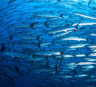
Field-based and drone assisted assessments of coral reefs, coastal ecosystems, and nearshore habitats, Our team provide baseline studies, long-term monitoring, and support for marine conservation and climate resilience.
Marine & Coastal Monitoring

Mapping. modeling, and spatial analysis using satellite imagery, drones (FAA-certified), and GIS tools. Services include land use change detection, habitat mapping, and custom visual dashboards.
Geospatial & Remote Sensing Solutions

We transform raw data into clear, actionable insights using statistical software (R, Python, ArcGIS) and custom dashboards. From water quality trends to ecological indicators, we help clients make informed decisions.
Data Analysis & Visualization

We connect scientists, engineers, and agencies with Indigenous and local communities through culturally respectful facilitation, OPS ensures research is ethically grounded, community-informed, and beneficial to all stakeholders.
Indigenous Collaboration & Knowledge Bridging

Full-service event coordination for scientific workshops, policy roundtables, community outreach, and corporate functions. From logistics to design, we ensure professional, culturally relevant, and smooth events.
Event Planning & Management